Monday, November 28, 2011

Supreme Court to Consider EQUAL FOOTING DOCTRINE, NAVIGABILITY, PROPERTY, FEDERALISM - PPL Montana, LLC v. Montana (10-218)

I received this from a friend, fellow paddler, HRWA member, and lawyer(!). 
I find it fascinating and thought others might as well.
Should be interesting to follow through the Supreme Court.
NB

<<This may bore you to tears but, I suspect, it may impact discussions for some of you on those creeks and bayous that you call home for the clubs. It will be argued before the US Supreme Court on December 7. So, keep an ear open for any commentary about it. Feel free to forward or to circulate.

Best wishes, Richard Clifford

PPL Montana, LLC v. Montana (10-218)

Oral argument: Dec. 7, 2011

Appealed from: Montana Supreme Court (Mar. 30, 2010)

EQUAL FOOTING DOCTRINE, NAVIGABILITY, PROPERTY, FEDERALISM

After a lawsuit against hydroelectric company PPL Montana was dismissed in federal court, PPL Montana sought a declaratory judgment in state court to determine the ownership of riverbeds along three Montana rivers. The State of Montana asserted that it owned the riverbeds under the equal footing doctrine, and sought compensation for PPL Montana's use of the land. The Montana Supreme Court affirmed the lower court's grant of summary judgment to Montana, holding that the State of Montana owned the riverbeds and that PPL Montana owed the State of Montana $40,956,180. The issue of title largely turns upon whether the river is "navigable." PPL Montana argues that navigability for title purposes should be determined by looking at individual segments of rivers and the actual commercial use of rivers at the time statehood was obtained. Montana contends that the proper navigability test is the susceptibility of travel through longer river stretches, which can be informed by current uses. The Supreme Court's decision may affect rivers' public benefits and the reliance interests of riverbed owners.


--   Richard C. Clifford, Esq. Attorney at Law 
Monday, November 14, 2011

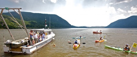
Nov 30: Riverkeeper presentation: Hows's the Water?

How’s the Water – and How Can We Improve It? A Joint Presentation by Riverkeeper and Clearwater, sponsored by the Yonkers Paddling and Rowing Club and the Hudson River Watertrail Association

kayaking_RvKPatrol_boat_
Photo courtesy Greg Porteus

When:
November 30, 2011: 6:30PM to 8:00PM
Where:
Beczak Environmental Education Center, 35 Alexander St. – two blocks north of the train station in Yonkers, NY map
The public is invited to join representatives from Riverkeeper’s Patrol Boat Program and the Hudson River Sloop Clearwater’s Green Cities program for presentations about water quality in the Hudson River and its tributaries, and what we can do to improve it.
The Hudson River has long defined the character and quality of life in our communities. In recent decades the Hudson has enjoyed a revival with increasing numbers of people wanting to live near it and recreate in it. However, our management of the river has not kept pace with its new role as a popular recreational destination.
For six years, Riverkeeper’s Patrol Boat and its scientific partners have been testing the water for sewage contamination and reporting the findings to the public. Riverkeeper will present data from its Water Quality Testing Program, and discuss opportunities to improve public notification of sewage discharges and Hudson River water quality for safer swimming, boating and fishing.
Because the cities of the Hudson River Valley drive regional economic development and have high concentration of diverse people and environmental concerns, Clearwater has developed the Green Cities Initiative. Clearwater will present its Green Cities programs, which include working with underserved communities in waterfront cities to include principles of sustainability – such as watershed protection, green infrastructure practices, environmental justice, and climate justice – into all phases of municipal and community planning.
Questions and discussion will follow the presentations.
This event is sponsored by the Yonkers Paddling and Rowing Club and the Hudson River Watertrail Association, and made possible by a grant from the Westchester Community Foundation. Attendees will be asked for a suggested donation of $5 to benefit Beczak Environmental Education Center.

Thursday, October 27, 2011

DEP and DEC reach draft agreement on Green Infrastructure for CSO control

From DEP's press release:

The New York State Department of Environmental Conservation and the New York City Department of Environmental Protection reached a draft agreement to reduce combined sewer overflows (CSO) into area water bodies, the agencies announced today. The agreement modifies New York City's approach to improving harbor water quality, under which the city will invest an estimated $187 million in green infrastructure projects by 2015, part of a planned $2.4 billion public and private investment over the next 20 years. The city will also complete work on approximately $1.6 billion in gray infrastructure projects. A public comment period on the proposal begins today and runs through November 18.

Go to October 19, 2011 ENB Notice for a summary of major changes to the CSO Consent Order, or fidn the entire document at 2011 CSO Order Modification.

Public Comment Period: The comment period commences on October 19, 2011 and concludes on November 18, 2011. Comments will be accepted by Gary Kline, NYS DEC – Division of Water, 625 Broadway, 4th Floor, Albany, NY 12233-3506 , Phone: (518) 402-9655, Fax: (518) 402-9029, E-mail: gekline@gw.dec.state.ny.us.

 —–>Public Meeting: A public meeting will be held at the NYS DEC – Region 2, Annex Building, 11-15 47th Avenue, Long Island City, NY 11101, on November 9, 2011 starting at 6:00 p.m.<—–

Monday, October 17, 2011

CITIZENS' WATER QUALITY TESTING PILOT starts this week

NYCWTA (nycwatertrail.org) is pleased to announce that we are ready to start a pilot program of Citizens' Water Quality Testing.
In partnership with The River Project (riverproject.org), we have purchased EPA-approved enterococcus testing kits from IDEXX Laboratories, the same system used by RiverKeeper and other community groups.  Enterococcus is a good indicator of the presence of human sewage, especially in brackish waters like those of the Hudson River estuary.
 
For the next six weeks, volunteers from NYCWTA member groups will be collecting water samples every Thursday at a half dozen locations on the west side of Manhattan, right at their launch sites, and delivering them to The River Project on pier 40, where the staff will conduct the testing. We will chart the results in order to establish a set of baseline data that can be compared with DEP and RiverKeeper data, and correlated with local rainfall totals.  If everything runs smoothly this fall, our hope is to secure funding for a season-long program next year that will gather near-shore water quality information at as many NYCWTA launch sites as is practical.

FAQs:
about the program:
• who is paying for the pilot program?  the pilot program is being funded by NYCWTA and The River Project.  If you'd like to help, any amount you wish to contribute would be appreciated.  You can make a donation through google at the NYCWTA website's Support page.
• which bacteria are you testing for, and why?  Enterococcus - Enterococci are commonly found in the feces of human and warm-blooded animals, and their presence in water--particularly brackish water as in the Hudson River estuary--is considered a reliable indicator of fecal pollution.
• where are samples being collected?  samples are being collected at  launch sites on the Hudson River and include:  pier 25, pier 40, pier 66, pier 96, west 72nd street,  west 133rd street, Inwood Canoe Club near Dyckman Street, and at the Yonkers Paddling and Rowing Club. 
• how long will it take for results from a given sample?  24 hours is the standard time a sample is allowed to cure in  an incubator to be counted.
• how do i get involved?  if you'd like to help collect and transport samples form one of our sites, or would like your launch to be added to our list, please contact us back-channel at info at nycwatertrail.org  We can't promise that we will be able to add sites to this fall's pilot program but we hope to expand our network in the spring.

for participants:
• when can i drop off my samples?  Thursday between 10am and 12pm at The Rover Project offices, room 224 on the second floor of pier 40 at the end of West Houston Street.  Please ask for Chris or Nina.
• how much water do you need, by volume, per sample?  At least one cup (8 fluid ounces / half a pint / 240 mL), taken one foot below the surface right at your launch site.
• is there a special vessel i need to use to collect the sample?  No, any clean jar with a lid will do. 
• is there a temperature above or below which the samples needs to be kept?  Samples should be kept kept as close to river temperature as possible and delivered no more than two hours after being taken from river.
• what information must i provide with my sample when i drop it off?  collection site, date and time of collection, your name and phone (in case there are questions). 

Thanks and we look forward to sharing the data with the community as it becomes available.

State Senate Hearing 10-14-2011, NYCWTA's Rob Buchanan's testimony


Good morning and thank you for convening this meeting.

My name is Rob Buchanan, and I am here on behalf of the Steering Committee of the New York City Water Trail Association, an umbrella group that aims to represent the common interests of the human-powered boating community and the more than 20 community boating organizations that now populate the harbor.

I am also a board member of two of those organizations--the Village Community Boathouse, a community rowing group based on Pier 40 in lower Manhattan, and the Brooklyn Bridge Park Boathouse, which offers free public kayaking and rowing on the Brooklyn waterfront.
The Water Trail Association's mission is to promote the safe use of the Water Trail that was established by the NYC Parks Department in 2007; to foster maritime education in, and environmental stewardship of, the harbor and the estuary; and to advance awareness of the public ownership of our urban waterways. One thing that sometimes gets overlooked in discussions about the harbor is that it is a public space, and, by far, our biggest Commons.

Sunday, October 16, 2011

NYCWTA on NPR

Last week NYCWTA testified at the NY State Senate Hearing concerning the Right to Know law being proposed by Senators Adriano Espaillat and Mark Grisandi which would require public notification of accidental and planned releases of sewage into public waterways and Rob and I were interviewed by NPR news.
The newsblog is below or here:
http://www.wnyc.org/blogs/wnyc-news-blog/2011/oct/14/calls-better-information-after-hudson-river-spills/
In the next few days we will post our testimony here along with that from RiverKeeper's Tracy Brown and John Liscombe, and our colleagues at Queens College and SWIM coalition.


Wednesday, September 21, 2011

October 14th: State Senate Hearing on Untreated Sewage in NY Harbor

On Monday, October 14th, the NY Sate Senate Environmental Conservation Committee, we invite you to join us at a crucial hearing examining the quality of water in New York, with respect to the presences of untreated sewage. As you may know, each year, billions of gallons of untreated sewage enters the Hudson River and other waterways in our state.

This hearing will serve to inform a Sewage Right to Know law for New York State that will be introduced by Senator Espaillat.
The full text of the letter from Senators Grisanti and Espaillat is available here.

Thursday, September 15, 2011

Fwd: Westchester Health Dept Advisory for LI Sound at Mamaroneck: LIFTED


For Immediate Release: September 15, 2011

MAMARONECK BOATER AND BEACH ADVISORY LIFTE

The Westchester County Department of Health has lifted a boater and beach advisory that had been in effect since Tuesday, due to a sewage discharge on Rushmore Avenue near the intersection of Orienta Avenue.

The discharge was discovered Monday night and ended Tuesday morning, after the county Department of Environmental Facilities repaired a pump that had failed at the West Basin Pump Station next to Harbor Island Park. An estimated 162,000 gallons of chlorinated sewage entered Long Island Sound due to the pump failure.

Results today from two sets of water samples taken by the health department following the discharge showed the water met bathing beach standards.

People who use the water for recreational purposes can resume their activities at the following beaches and marinas: Harbor Island Park Beach, Mamaroneck Beach and Yacht Club, Shore Acres Club, Beach Point Club, Orienta Beach Club, Derecktor Boat Yard, Brewer Post Road Boat Yard Marina, Mamaroneck Municipal Marina, Nichols Yacht Yard, Mamaroneck Boat and Motors, and McMichael's Boat Yard.  No other beaches or marinas were affected.

Caren Halbfinger

Director, Public Health Information and Communication

Westchester County Health Department

cqh4@westchestergov.com

914-813-5013 phone ;After hours: 914-813-5000

914-813-5014 fax

145 Huguenot Street

New Rochelle, New York 10801

Wednesday, September 14, 2011

Westchester Health Dept Advisory for LI Sound at Mamaroneck

thanks to jerry blackstone for forwarding this.
 

NEWS RELEASE

Cheryl Archbald, MD, MPH,   Acting Commissioner, Department of Health
Ned McCormack, Communications Director
Contact:  Caren Halbfinger (914) 813-5013 / after hours:
813-5000


For Immediate Release: September 13, 2011


BOATER AND BEACH ADVISORY: SEWAGE SPILL INTO THE SOUND IN MAMARONECK


The Westchester County Department of Health has issued a boater and beach advisory due to a sewage discharge at the West Basin Pump Station next to Harbor Island Park. The discharge was discovered Monday evening and ended this morning after the county Department of Environmental Facilities repaired a pump that had failed.

The advisory, along with telephone notification to the marinas and beaches, is being made because an estimated 162,000 gallons of untreated sewage entered Long Island Sound due to the pump failure.

As a precaution, Mamaroneck beaches have been advised to remain closed and people who use the waters for recreational purposes should avoid direct contact with the water until further notice at the following Mamaroneck locations: Harbor Island Park Beach, Mamaroneck Beach and Yacht Club, Shore Acres Club, Beach Point Club, Orienta Beach Club, Derecktor Boat Yard, Brewer Post Road Boat Yard Marina, Mamaroneck Municipal Marina, Nichols Yacht Yard, Mamaroneck Boat and Motors, and McMichael's Boat Yard. 

The county health department is sampling the water today. Once results are received and evaluated, the health department will determine whether to reopen the beaches and lift the advisory.

Wall Street Heliport Security Zone Enforcement - Temporary East River Closures Sept. 19th AND 21st

This advisory is the same for both days, so I have pasted in the date and time for both.
For charts and more info click on "read more" below.

Date: September 13, 2011
Re: Wall Street Heliport Security Zone Enforcement - Temporary East River Closure

1. In accordance with regulations contained in 33 CFR 165.164(a)(1), the Coast Guard will be enforcing a security zone in the East River, in the vicinity of the Wall Street Heliport, on Monday, September 19, from 4:40 pm to 5:40 pm AND Wednesday, September 21, from 8:50 pm to 9:50 pm. No vessel transits will be permitted within the security zone while it is in effect without the Coast Guard Patrol Commander's (PATCOM) approval. Changes in the time that the security zone is in effect may occur. In the event additional waterways need to be closed under urgent conditions, or changes occur to the security zone, immediate notice will be made to mariners via safety marine information broadcast over VHF-FM Channel 16 and the Homeport Alert Warning System. VTS participants will also receive notice via VHF-FM Channel 12 and 14.

UN General Assembly - East River Closures / Security Zones for Sept 19-27

For charts and further info click on "read more"

Date: September 12, 2011
1. From September 19-27, 2011, the U.S. Coast Guard will be enforcing additional Security Zones on the East River near the United Nations Headquarters. The security zone includes all waters of the East River between East 35th Street and the Queensboro/59th Street Bridge.

East River Security Zone Restrictions
•  Zone (1): This zone is always in effect. No Vessels within 175 yards of Manhattan between East 35th Street and the Queensboro/59th Street Bridge in the West Channel of the East River. Commercial vessels must check in with VTS New York (VTSNY) on VHF-FM CH 12 prior to entering the West Channel.
•  Zone (2): West channel closure: Sept 19-23 and Sept 26 &amp; 27 (7:00 am-7:00 pm). No commercial or recreational traffic in the west channel of the East River between East 35th Street and the Queensboro/ 59th Street Bridge. NYC DEP sludge vessels will not be allowed to transit without 24-hour advance coordination with the Sector NY Enforcement Division.
•  Zone (3): Full river closure: Sept 19, (5:20 pm-6:30 pm); Sept 20, (10:00-11:45); Sept 21, (9:25-2:45). No commercial or recreational traffic in the East River between East 35th Street and the Queensboro/59th Street Bridge except commercial passenger vessels on the east channel with USCG PATCOM approval.

Tuesday, September 6, 2011

Harlem River Closure, Thu, Sep 8, 0455-0505, from 3rd Ave Bridge to RFK/Triborough Bridge

Just a heads-up. This appears to be very early in the morning but in case anyone planned to be out on the Harlem Thursday morning see below.
This is the entire notice from Homeport.  No explanation was provided.:

Re: Harlem River Closure, Thu, Sep 8, 0455-0505, from 3rd Ave Bridge to RFK/Triborough Bridge

REQUIRED SAFETY MEASURES:
1.    The Harlem River will be closed on Thursday, September 8th, 2011 from 0455-0505. No vessels will be authorized between the Third Ave Bridge and the Triborough/RFK Bridge.
2.    NYPD and FDNY Harbor vessels will be on scene.
3.    Miller's Launch will have a small boat near each bridge to also notify mariners of the closure.
4.    POC: LT William George at (718)-354-4114.

Wednesday, August 31, 2011

Hudson River Advisory LIFTED by Westchester Health Dept

FOR IMMEDIATE RELEASE: August 30, 2011


HUDSON RIVER ADVISORY IN WESTCHESTER LIFTED


The Westchester County Department of Health has lifted the Hudson River advisory that was issued for points in Westchester County south of Tarrytown. Westchester County had issued the advisory for recreational use yesterday due to a sewage discharge from the North Yonkers Pump Station. The Department of Environmental Facilities notified the Health Department today that the discharge had ceased last night.  The advisory is being lifted because the elapsed time since the discharge was stopped has allowed it to dissipate.

Tuesday, August 30, 2011

Health Advisory on the Hudson River in WESTCHESTER, south of Tarrytown

Thanks to Jerry Blackstone of YPRC for this:
HUDSON RIVER ADVISORY: AVOID CONTACT WITH THE HUDSON RIVER
IN WESTCHESTER FROM POINTS SOUTH OF TARRYTOWN
Sewage discharge in Yonkers prompts water advisory

The Westchester County Department of Health is advising people who use the Hudson River waters for recreational purposes, namely swimmers, boaters, windsurfers and kayakers, to avoid direct contact with the Hudson River from points south of Tarrytown in Westchester until further notice.
Due to the excessive rainfall associated with Hurricane Irene, the Department of Environmental Facilities has reported a sewage discharge into the Hudson River from the North Yonkers Pump Station. The volume of water coming into the North Yonkers Pump Station was too much for the system to handle, causing a manhole cover to dislodge resulting in a sewage discharge into the Hudson.  The Department of Environmental Facilities has been working to remediate the issue.
The Department of Environmental Facilities will be collecting samples from the surcharging sewer manhole this evening and the Health Department will issue an updated advisory based on the sample results. 
The New York State Department of Environmental Conservation and the New York State Department of Health have been notified.

Friday, August 26, 2011

Hurricane Irene closure: Hudson River Park will close at noon on Saturday

FOR IMMEDIATE RELEASE

FROM: HUDSON RIVER PARK TRUST (www.hudsonriverpark.org)

24/7 Operations

CONTACT: Hudson River Park Trust

212-242-6427


HUDSON RIVER PARK CLOSURE

INFORMATION DUE TO HURRICANE IRENE

Hudson River Park will close at NOON on Saturday, August 27, 2011, due to Hurricane Irene. The closure will be in effect until further notice.

Hudson River Park is located within Zone A of the City's Hurricane Evacuation Plan. Mayor Bloomberg has ordered a mandatory evacuation of all residents in Zone A. While there are no residents in the park, the closure is a critical precautionary safety measure.

Preparations for anticipated high winds and storm surges continue throughout the park. All tenants have been alerted to take precautionary measures, and we will provide more details as they become available. Any tenant having questions or concerns should contact the Hudson River Park Trust's 24/7 command number above.

As well as open publicly accessible portions of the park, the following buildings will close tomorrow at noon: Pier 25 Mini Golf Building, Tribeca Skate Park/Comfort Station Building, Christopher Street Comfort Station, Organicoa Concession at Christopher Street, Pier 51 Comfort Station, West 26th Street Park Maintenance Building, Pier 66 Boathouse, Pier 84 Boathouse, Pier 84 Bike Concession/Comfort Station, and the Pier 96 Boathouse.

In addition, recreational motorized and non-motorized boating at Pier 25, Pier 40, Pier 66, Pier 84 and Pier 96 will be strictly prohibited for safety. The sports fields at Pier 40 will be closed at noon. The Trust will likely need to close Pier 40 entirely tomorrow. Business owners or garage patrons who need to access Pier 40 to retrieve a car or relocate it to the second floor should do so before 5 pm tomorrow.

We will continue to follow the direction of the Mayor's and Governor's offices which are coordinating emergency response measures across the City and State. Keep in mind that plans for Hudson River Park closures may change at any point in response to updated weather other emergency conditions. We will endeavor to keep our website updated to provide current information to the degree possible.

The safety of our patrons, tenants and staff members is our highest priority. Please do everything you can to keep yourselves and the park we all love safe.

###

Thursday, August 25, 2011

Coast Guard Advisory Notice: Hurricane Irene

This does not apply specifically to human-powered boats, but is a reminder that bad weather may be on the way this weekend.  Really bad weather.  Plan your programs and trips for the weekend accordingly.
Be safe.

From:  Waterways Management Division
Re:  Hurricane Irene
Date: August 25, 2011
Revision No: 0
CGAN NUMBER: 2011-058

1.    Hurricane Irene may impact waters of the Sector New York Captain of the Port Zone beginning Saturday evening. All vessels and facilities should review their heavy weather and hurricane plan. The Sector New York Maritime Heavy Weather and Hurricane plan can be found at: http://homeport.uscg.mil/newyork >Port Directory > Local Contingency Plans > 01. Hurricane and Severe Weather Plan
2.    Pleasure crafts are advised to seek safe harbor if weather conditions begin to deteriorate.
3.    Drawbridges may not be operating if sustained winds reach 35 knots.
4.    All commercial vessel and barges greater than 500 gross tons should make preparations and preliminary arrangements for safe mooring.
5.    Mariners are strongly advised to closely monitor NOAA weather and local radio broadcasts for updated warnings of this storm.

Tuesday, August 23, 2011

NEW KAYAK LAUNCH TO BE OPENED IN OSSINING, August 28, 2011 at 11 a.m


NEW KAYAK LAUNCH TO BE OPENED IN OSSINING
New Kayak Launch and Racks Will be Open to the Public, the Racks First Come First Serve

August 28, 2011 at 11 a.m., the Town of Ossining will be hosting a press conference to announce
the opening of their new kayak launch. The kayak launch will have public storage racks available
to all on a first-come-first-serve basis.

Town of Ossining Department of Parks & Recreation Department also works closely with the Ossining Boat & Canoe Club, committed to continuing our role on the waterfront as a living interface between the Ossining community and the Hudson River, one of our country's great natural resources.
If you would like more information about this topic, or to attend the Press Conference, please
call Amanda Porteus at 484-753-2532 or email Amanda at amandaporteus@me.com.

Thursday, August 18, 2011

Kayaker Needed

The Hudson River Swim For Life
Sat, 09/10/2011 - 6:30am
Website for more information and to register:
http://www.hudsonriverswim.org

Time shown represents the registration start. The actual event which is open for public viewing will start around 9:00am
For 20 years, The Hudson River Swim For Life has been recognized as the premiere swim on the Hudson. The 2011 event takes place on Saturday, September 10th at Kingsland Point Park in Sleepy Hollow, NY. All proceeds from the Swim will benefit the Westchester/Hudson Valley Chapter of The Leukemia & Lymphoma Society (LLS).

Participants will have several options to conquer the Hudson and support The Leukemia & Lymphoma Society:
Three-Mile Swim: A once in a lifetime experience swimming across the Hudson River! This swim begins in Nyack and finishes at Kingsland Point Park in Sleepy Hollow.

One-Mile Swim: For those swimmers interested in completing a shorter route, a One-Mile Swim will be offered along the shores of Sleepy Hollow.

Kayaking: For those who would like to participate on the water rather than in it, we welcome you to participate as a kayaker. These volunteers are essential to guiding and assisting the swimmers in the water for safety. This year’s event is expected to require 150 kayakers. FYI: Kayakers will be going across the river and back, therefore you may be kayaking for 1-6 miles based on your ability.

*There is a $20 registration fee before the day of the event and $25 on the day of. Kayakers will be provided with food and a shirt.
Since its inception over 20 years ago, the mission of the Hudson River Swim For Life has been to raise awareness of the Hudson River, promote swimming as a lifelong form of fitness, and to raise funds for the ongoing efforts of charities in the community. Overall, the event has raised approximately $2 million for local non-profit organizations.

Spectators are welcome to cheer on the participants. There will be food and entertainment to enjoy in the park.
for more information check out http://www.hudsonriverswim.org or contact Diandra Kodl at 914-949-0084, ext. 8993 or Diandra.Kodl@lls.org.


:: Diandra Kodl | Deputy Executive Director:: The Leukemia & Lymphoma Society | Westchester/Hudson Valley Chapter, 1311 Mamaroneck Ave., Ste 130, White Plains, NY 10605

Sunday, August 14, 2011

CONTACT WITH THE HUDSON RIVER IN WESTCHESTER CLEARED SLEEPY HOLLOW AND SOUTH

NEWS RELEASE

Cheryl Archbald, MD, MPH, Acting Commissioner, Department of Health
Ned McCormack, Communications Director
Contact: Caren Halbfinger (914) 813-5013 / after hours: 813-5000

FOR IMMEDIATE RELEASE: August 13, 2011

CONTACT WITH THE HUDSON RIVER IN WESTCHESTER CLEARED SLEEPY HOLLOW AND SOUTH

Philipse Manor Beach can reopen; Croton Point Park Beach remains closed.


The Westchester County Department of Health advises swimmers, boaters, windsurfers, kayakers and other recreational water users that they may resume direct contact with the Hudson River in Sleepy Hollow and south in Westchester but should avoid direct contact with the Hudson River north of Sleepy Hollow in Westchester until further notice.

The health department estimates there had been an ongoing sewage discharge of 1.5 million gallons per day of sewage due to the sewer main break reported by Ossining on Thursday.  The village of Ossining repaired the sewer main break late afternoon on Friday.

 The county health department has advised that one of the two Hudson River beaches in Westchester, Philipse Manor Beach, can reopen.  Croton Point Park Beach must remain closed.

Results from beach water quality samples taken Friday by the county health department were available late this afternoon and showed improved water quality in Sleepy Hollow and south and ongoing unacceptable levels of bacteria in areas north of Sleepy Hollow.

 The Health Department will continue to monitor the situation and will update this advisory when possible.

For more information regarding the repaired sewer main, contact the Village of Ossining.


Friday, August 12, 2011

August 11, 2011 AVOID CONTACT WITH THE HUDSON RIVER IN WESTCHESTER

this is unrelated to last month's sewage treatment plant failure in northern manhattan.  seems one positive thing that came from that event is raised awareness of the water quality.

NEWS RELEASE

       Cheryl Archbald, MD, MPH, Acting Commissioner, Department of Health
       Ned McCormack, Communications Director
       Contact:  Caren Halbfinger (914) 813-5013 / after hours: 813-5000

       FOR IMMEDIATE RELEASE: August 11, 2011

                 AVOID CONTACT WITH THE HUDSON RIVER IN WESTCHESTER

                   Sewage Discharge in Ossining Closes Two Beaches

       The Westchester County Department of Health has notified area marinas
       and boating clubs and has advised Croton Point Park Beach and Philipse
       Manor Beach to close today, as a result of a sewer main break in
       Ossining.

       The Westchester County Department of Health was notified of the
       incident today and also advises people who use the Hudson River waters
       for recreational purposes, namely swimmers, boaters, windsurfers and
       kayakers, to avoid direct contact with the Hudson River until further
       notice.  The Health Department is collecting beach water quality
       samples today and will issue an updated advisory based on sample
       results received tomorrow.

       The village of Ossining today reported that a fallen tree had caused a
       break in an 18-inch sewer main, which is discharging sewage into
       Killbrook Creek, near the intersection of Water Street and Central
       Avenue in Ossining, about a quarter mile from the Hudson River. The
       health department estimates 1.5 million gallons per day of sewage is
       discharging due to the break. The village is adding chlorine solution
       upstream to provide partial treatment of the sewage before it is
       discharged to the Hudson River, and is working to repair the break.

       The health department will continue to monitor the situation and
       respond as needed.

       The New York State Department of Environmental Conservation,the New
       York State Department of Health, and the New York City Department of
       Environmental Protection have been notified.

       For more information on the status of repairs to the sewer main break,
       contact the Village of Ossining.

Friday, July 29, 2011

Riverkeeper's Hudson River sampling data july 19, 21, 22, 25

Riverkeeper's data shows where in the channel the samples were taken, which is very useful to people who operate small boats such as human-powered craft, and to swimmers or those who merely dip their feet in the water to cool off.
Charts are here:

7/28 DEP Update on North River Wastewater Treatment Plant Fire and Impacts

These excerpts are what I imagine will be of most interest to viewers of this blog:
"The New York City Health Department has lifted the beach pollution advisory for
Sea Gate in Brooklyn as well as the beach closure notices for South Beach, Midland Beach
and Cedar Grove Beach in Staten Island starting immediately. The most recent water quality
sampling indicates that bacteria levels found at these locations and in New York Harbor
has returned to acceptable levels. Additionally, the Health Department has determined that
recreational activities may resume in the Hudson River, the East River from the Robert F.
Kennedy Bridge to Verrazano Bridge, the Harlem River and the Kill Van Kull to the Goethals
Bridge. These waterways are now fit for recreational activities that entail possible direct
contact with water."
"Warning signs at beaches and kayak launches will be removed as a result. Specific
beach information continues to be available to the public through website postings at the City's
beach website www.nyc.gov/health/beach, at www.nyc.gov under NYC Right to Know, and at
www.nyc.gov/health, the City Information Hotline 311, and those who have signed up to Notify
NYC will receive up to date status information relating to public beaches via Twitter, RSS, email
and SMS."

Note that specific beach information continues to be available but information on  other waterways continues to be UNavailable.


FOR IMMEDIATE RELEASE:
July 28, 2011
No. 72

Update on North River Wastewater Treatment Plant Fire and Impacts

Overview of Incident

The North River Wastewater Treatment Plant was taken offline last Wednesday
afternoon following a four-alarm fire in the engine room that started at approximately 11:45 am
that morning. At approximately 5:15 pm Wednesday, untreated wastewater started to be directly
discharged into the Hudson River. The North River plant has been in operation since 1986 and
treats an average of 120 million gallons of wastewater a day from Manhattan's west side from
Bank Street through northern Manhattan.

Wednesday, July 27, 2011

Hudson River Advisory Lifted in Westchester

Good news: All Clear in Westchester:

HUDSON RIVER ADVISORY LIFTED: HUDSON RIVER IN WESTCHESTER IS CLEARED
FOR RECREATION

The Westchester County Department of Health has lifted its advisory
for the Hudson River in Westchester. Residents can now resume all
recreational water activities along the Hudson River in Westchester.
This includes swimming, fishing, windsurfing, kayaking and jet skiing.

The Westchester County Department of Health is lifting the advisory
based on the results of Hudson River sampling performed by the
Westchester County Department of Health to date.  This advisory
originally followed a fire that took the New York City North River
Waste Water Treatment Plant out of service last week. The treatment
plant is located at W. 135th Street and 12th Avenue in New York City.

The Health Department will resume its routine water sampling of the
Hudson River.

The New York City Department of Environmental Protection will be
providing updates on the situation as needed at
http://www.nyc.gov/html/dep/html/home/home.shtml.

Tuesday, July 26, 2011

All Clear North of Hastings


NEWS RELEASE
Cheryl Archbald, MD, MPH, Acting Commissioner, Department of Health
Ned McCormack, Communications Director
Contact: Caren Halbfinger (914) 813-5013 / after hours:
813-5000
For Immediate Release: July 25, 2011
REVISED HUDSON RIVER USE ADVISORY: HUDSON RIVER FROM HASTINGS NORTH IS CLEARED FOR RECREATION; AVOID HUDSON RIVER CONTACT SOUTH OF HASTINGS UNTIL FURTHER NOTICE
The Westchester County Department of Health advises people who use the Hudson River waters south of Hastings for recreational purposes, namely swimmers, windsurfers and kayakers, to continue to avoid direct contact with the Hudson River until further notice. There are no restrictions to boating. Those who fish should practice catch and release from all points south of Hastings.
The Westchester County Department of Health has lifted the advisory for areas of the Hudson River from Hastings north, including Philipse Manor Beach., based on the results of Hudson River sampling performed by the Westchester County Department of Health to date. This advisory originally followed a fire that took the New York City North River Waste Water Treatment Plant out of service. The treatment plant is located at W. 135th Street and 12th Avenue in New York City.
The Health Department will continue to monitor the situation and update any advisories as necessary.
The New York City Department of Environmental Protection will be providing updates on the situation as needed at http://www.nyc.gov/html/dep/html/home/home.shtml.


Sunday, July 24, 2011

New info on Riverkeeper and DEP sampling - 5:36pm Saturday 7/23


New info provided by Phillip Mesegaas at Riverkeeper.  Our thanks again to him and the others who have made an effort to keep the human-powered boating community informed.

The DEP has posted water quality sampling results for 7/21 for the waters potentially affected by the sewage discharges related to the fire and temporary closure of the North River sewage treatment plant, on the DEP website at http://www.nyc.gov/html/dep/html/news/north_river_wastewater_treatment_plant_fire.shtml

Riverkeeper and our science partners also sampled on 7/21 from the Tappan Zee bridge to the Battery. In the section of River west of Manhattan, we sampled in a grid pattern to determine the impacts on the Manhattan shoreline as well as mid channel and on the new Jersey side of the River.

Overview:
1) Our data adds new and different information to DEP's data, especially as it relates to the pattern and degree of contamination in the near shore environment.
2) Our data shows that the NJ shoreline, mid-channel and Manhattan shoreline data are very different. It matters where one samples and our data shows extreme pollution levels along the NY shoreline, based on our sampling results from nearshore sampling locations.  To the best of our knowledge, DEP did not take samples in the nearshore area.
3) For protecting public health it is important that people are aware of the potentially high levels of pollution in the shoreline environment because that is where people generally contact the water.
4) The highest level of contamination in DEP's sampling results numbers appears to be 400 Entero cells/100ml; our additional near shore sampling has the highest count from the same day of 104,620 Entero cells/100ml.

Details:
This difference between Riverkeeper and DEP data has very important implications regarding how samples were collected, and what is sufficient for proper notification and protection of public health.  Note below the patterns seen in Riverkeeper's data when sorted by sampling location.  While we don't know the exact details of where in the river the DEP collected, we think that differences in sampling locations likely accounts for the discrepancy (given the patterns in our data) and this is VERY IMPORTANT for the public's understanding of this event.
 
Note:  for salt or brackish water the federal guideline for unacceptable water quality is a single sample value above 104 Enterococcus per 100/ml.

If we had conducted the survey by sampling ONLY close to the western shoreline (NJ), our data shows the following:
Englewood Boat Basin     <10 Enterococcus per 100/ml
Edgewater Marina              31
Weehawken                    <10
Castle Point (NJ)             <10

If we had sampled ONLY down the middle of the river our data shows the following:
Tappan Zee Mid River         <10 Enterococcus per 100/ml
Yonkers Mid River              <10
GWB Mid River                     313
125th St Mid River               74
79th St Mid River                 Duplicate samples 132 and 161
Battery Mid River                 10

In contrast, our sampling numbers from the eastern shoreline (Manhattan) indicates intense near shore contamination of the near shore area:
Hudson at Yonkers where Sawmill R. enters                      <10 Enterococcus per 100/ml
Westchester/Yonkers Sewage Treatment plant outfall       <10
Dykeman Street at public pier                                           >24,196
125th Street Pier     (1/10 dilution maxed out at >24,196)      1/100 dilution = 104,620
79th St Boat Basin entrance                                               1722
Pier 96 (kayaking area)                                                      12,033

Conclusions:   
1) It matters how/where one samples. On the 21st, mid-channel samples alone would miss most of the contamination (since overflow points were mostly in the Manhattan near shore environment).  Near shore sampling is important to proper notification and protection of public health because people are more likely to be coming into contact with the water near shore. We saw people in the water on the west side of Manhattan on both the 21st and 22nd).  
2) Our data shows that while many sites far removed from the point sources (pipes used for bypass) did not show a large signal, sites that are in close proximity to the discharging pipes (most of the Manhattan eastern shore of the Hudson) had very high levels of contamination.
3) Tidal differences or a slight offset in the timing of sample collection may account for some of the observed differences, especially in north/south extent of contamination.
4) The public need to be aware of the higher contamination levels in the near shore areas, in order to provide the highest level of protection of public health, since this is where much of the public uses the River.  
 
Phillip Musegaas, Esq.
Hudson River Program Director
Riverkeeper, Inc.


Saturday, July 23, 2011

Updated list of Boating Groups' Program Cancelations

The groups below have reported cancelations of some or all of their public boating programs for this weekend.
We recommend contacting specific organizations for details of their cancelations and conditions at their launch sites.
For links to additional clubs see http://nycwatertrailweb.blogspot.com/p/community-boating-groups.html

Brooklyn Bridge Park Boathouse  www.bbpboathouse.org
Downtown Boathouse  www.downtownboathouse.org
Friends of Brook Park  www.friendsofbrookpark.org
Harlem River Boat Club  www.harlemrivercommunityrowing.org
Hoboken Cove Community Boathouse  www.hobokencoveboathouse.org/
Inwood Canoe Club  www.inwoodcanoeclub.com
Long Island City Community Boathouse  www.licboathouse.org/
New York Kayak Polo  www.nykayakpolo.org
New York Outrigger  www.newyorkoutrigger.org
Village Community Boathouse  www.villagecommunityboathouse.org
Yonkers Paddling and Rowing Club  www.yprc.org

Latest briefing from DEP - 4:27pm on Jul 22, 2011

Let's hope this s the beginning of the end of this particular nightmare.

---------- Forwarded message ----------
From: Phillip Musegaas
Date: Fri, Jul 22, 2011 at 6:03 PM
Subject: FW: latest briefing from DEP?
To: Nancy Brous <nbrous@gmail.com>, rob buchanan <avironvoile@gmail.com>


Latest news, looks like pumps are running, and I've heard they may stop the bypass discharges this evening.  Would you distribute?

Phillip Musegaas, Esq.
Hudson River Program Director
Riverkeeper, Inc.

http://www.centredaily.com/2011/07/22/2851675/pumps-working-at-nyc-plant-that.html

Pumps working at NYC plant that spilled sewage

The Associated Press
Posted: 4:16pm on Jul 22, 2011; Modified: 4:27pm on Jul 22, 2011
NEW YORK — Pumps resumed working Friday at a wastewater treatment plant that spilled millions of gallons of raw sewage into the Hudson River, and officials expressed hope that the discharges would end in the evening.
Department of Environmental Protection Commissioner Caswell Holloway said at a Friday afternoon briefing that the pumps were handling all of the incoming flow, and sewage that had been stored in the system was being reduced.


_________________________________
Lawrence Levine
Senior Attorney, Natural Resources Defense Council
40 W. 20th Street
New York, NY 10011
(212) 727-4548
PRIVILEGE AND CONFIDENTIALITY NOTICE
This message is intended only for the addressee and may contain information privileged confidential, and exempt from disclosure under law.  If you are not the intended recipient, please notify me immediately by email and delete the original message.

Follow us on Twitter: http://twitter.com/NRDCNY


Friday, July 22, 2011

Public Boating Program Cancellations due to Sewage Release

Please be advised that the following organizations have alerted NYCWTA that they have canceled all or some of their public paddling programs scheduled for this weekend due to an extraordinary release of raw sewage into the Hudson and Harlem Rivers caused by a DEP treatment plant fire on Wednesday.
Please check directly with the organization you planned to boat or volunteer with this weekend for further details about their program cancelations.
For links to check with other area boating groups not listed below see http://nycwatertrailweb.blogspot.com/p/community-boating-groups.html

Brooklyn Bridge Park Boathouse  www.bbpboathouse.org
Downtown Boathouse  www.downtownboathouse.org
Friends of Brook Park  www.friendsofbrookpark.org
Hoboken Cove Community Boathouse  www.hobokencoveboathouse.org/
Inwood Canoe Club  www.inwoodcanoeclub.com
New York Kayak Polo  www.nykayakpolo.org
New York Outrigger  www.newyorkoutrigger.org
Village Community Boathouse  www.villagecommunityboathouse.org
Yonkers Paddling and Rowing Club  www.yprc.org

We will do our best to keep everyone as up to date as possible on further developments.
NYCWTA

Thursday, July 21, 2011

From the RiverKeeper:

NYC Sewage Treatment Plant Dumping Raw Sewage into Hudson After Fire


Since 5:15 p.m. yesterday, the North River Wastewater Treatment Plant, at 135th Street in New York City, began discharging untreated sewage into the Hudson River following a four alarm fire that caused severe damage and the shutdown of the plant. Riverkeeper is relieved that no one was seriously injured in the fire or subsequent evacuation of Riverbank Park, and fully supports the Department of Environmental Protection’s (DEP) efforts to bring the treatment plant back online as soon as possible. However, we are concerned that the city’s efforts to notify the public have been inadequate and potentially confusing, and do not fully inform the public as to the risks posed by such a massive discharge of sewage into the Hudson.

For example, the DEP and New York City Department of Health and Mental Hygiene have issued a combined statement that focuses primarily on official swimming beaches and provides a very vague warning about recreating in the river, ignoring the fact that thousands of New Yorkers recreate on the Hudson from riverfront parks and boats, often far from designated public beaches such as Jones Beach. Riverkeeper considers the entire Hudson River estuary a “beach” during the boating and swimming season – New York City should do the same, to ensure that all New Yorkers are protected from the potential health effects of sewage discharges like this one. Any discharge of sewage is unacceptable and must be prevented at all costs.

“When accidents like this happen, it is critical that NYC officials speak with one voice, and provide the public with accurate, consistent information about the public health risk and environmental impacts that result,” said Phillip Musegaas, Hudson River Program Director at Riverkeeper. “New Yorkers use the entire Hudson, New York Harbor and East River for recreation, not just Jones Beach. The city’s public notification effort must reflect that fact, and ensure that all New Yorkers who want to enjoy the city’s “Sixth Borough” can do so with the best information available.”

Given the large number of organized boating events scheduled over the next few days in NYC, it is critical that the Health Department update this advisory and provide the public with better information on the geographic scope of sewage contamination in the Hudson River, and the risk to public health it represents.

The North River plant is located on the Hudson River, west of the West Side Highway from 137th Street to 145th Street and provides wastewater treatment for the hundreds of thousands of people who live and work in or visit the west side of Manhattan, from Bank Street in Greenwich Village to Inwood Hill at the island’s northern tip. North River has the capacity to treat 140 million gallons of sewage per day, but it is unknown how much has been dumped into the Hudson since yesterday afternoon. Based on its capacity, it is likely that millions of gallons of sewage have been discharged.

Update on North River treatment plant overflow - 6:47pm 21 July 2011

a little more info from riverkeeper.  thanks again to phillip musegaas.
most up to date list of outfalls is below his email.
sorry to be the bearer of bad news to quite a few people who were on the water last night from pier 66, but note that one of the outfalls is right AT west 26th street. 
nb

---------- Forwarded message ----------
From: Phillip Musegaas
Date: Thu, Jul 21, 2011 at 6:47 PM
Subject: RE: update on North River treatment plant overflow

Nancy and Rob,
Thanks for the emails today – here's what I know at this point, some of it's probably old news but I thought I'd share anyway.  Feel free to call or email me with questions or ideas.  The plant permit is attached, which has the list of CSO outfalls, some of which are being used for this bypass.  Let me know if you want me to send a list of the outfalls and GPS coordinates.
Here is a link to the statement on our website – I'm going to update it tomorrow morning.

-          DEC confirmed that the inflow is being diverted to at least seven permitted CSO outfalls, located along the west side of Manhattan from Dyckman street down to 18th street, and on the Harlem River at Academy St. and W. 203rd st.   hypochlorite is being added to the discharge at 158th street, but that's the only treatment occurring, and Larry Levine reminded me that it's known to be not very effective and possibly more harm than good to aquatic life.  This is a key point we need to get out to the public, that this is not one big discharge happening from the plant, but sewage discharges all along the west side of Manhattan, and at least two locations on the Harlem River.
-          DEP predicts that 120 million gallons have been discharged since yesterday at 515 pm, when the bypass began – this matches up with the avg. flow of the plant, not actual field measurements of flow.  If they don't get the plant up and running by tomorrow, they are expecting to announce beach closures by tomorrow afternoon, not sure which ones though.
-          The Riverkeeper boat is taking samples at the outfall locations today, and will head down tomorrow to resample.  We just finished a sampling run about a week ago, also dry weather – early results from that run show acceptable water quality in every sampling location except Gowanus.   I'll share sample results from North River as soon as we have them, the contrast between the two should be interesting.
-          Jim Tierney at DEC gave me the following info on the plant condition – 1 pump/engine destroyed, one badly damaged, two possibly operational – they've brought in portable generators to the site, because ConEd is very hesitant to reconnect the plant to the grid until they know the condition of electrical systems, and possibly more about the cause of the fire.  They believe if they can get one pump running, they can begin primary treatment and disinfection on a broader scale.  Tierney also mentioned beach closures, and made a point of saying they wouldn't reopen beaches until sampling showed clean water. 
o   DEP and DEC have also convened a "bypass group" that is running a hydroqual model of bypass impacts – however, the model only assesses the impacts on designated swimming beaches, hence the early language about a 48 hour window before beaches would be closed. 
-          Coast Guard issued a radio advisory this afternoon on Channel 16, informing boaters about DEP's advisory.  Otherwise they are diverting all info requests back to DEP.

I think those are the key points – I spoke to lots of media today, core message was 'we need better public notification – more timely, more detailed, more interagency coordination, and specific advisories on the health risks and geographic scope of the advisory.'  I think the press release suggests DEP  is slowly moving in the  right direction, but it took them almost 24 hrs!  John Lipscomb, our boat captain, sent me a photo of guys swimming near Dyckman, south of the main CSO bypass outfall this afternoon.
Thanks,
Phillip


Phillip Musegaas, Esq.
Hudson River Program Director
Riverkeeper, Inc.

GPS coordinates for the CSO outfalls being used for the discharge are below, thanks. This is based on info from DEC Region 2 today.  I have a feeling they will add more outfalls, since we alerted them to 006 this afternoon.
            Latitude          Longitude         Location
 NR-023      40,44,42          74,00,36          W. 18th Street (6 blocks north of NR050)
NR 003      40,50,07          73,56,56          W. 158th St.  (just north of Riverkbank State Park and Trinity Cemetery)
NR 050      40,44,30          74,00,36          Bloomfield Street (Meatpacking District- 6 blocks south of NR023)
NR 045      40,51,35          73,54,56          Academy Street (Discharging into the HARLEM River)
NR 026      40,45,11          74,00,32          W. 26th Street (8 blocks north of NR 023)

NR 016      40,51,43          73,54,49          Harlem River, W. 203rd st.
NR 006      40, 52,10         73,55,46          Dyckman St.

Riverkeeper Sewage Release Notice

Sorry for the delay.  It was imperative to get this info to the area immediately surrounding the CSOs first.
This is from earlier today from Riverkeeper.  NYCWTA will try to keep you updated as more information is made available.
NB


convio e-mail wrapper - important notice
NYC Sewage Treatment Plant Dumping Raw Sewage into Hudson After Fire

Since 5:15 p.m. yesterday, the North River Wastewater Treatment Plant, at 135th Street in New York City, began discharging untreated sewage into the Hudson River following a four alarm fire that caused severe damage and the shutdown of the plant.  Riverkeeper is relieved that no one was seriously injured in the fire or subsequent evacuation of Riverbank Park, and fully supports the Department of Environmental Protection's (DEP) efforts to bring the treatment plant back online as soon as possible.  However, we are concerned that the city's efforts to notify the public have been inadequate and potentially confusing, and do not fully inform the public as to the risks posed by such a massive discharge of sewage into the Hudson. 

For example, the DEP and New York City Department of Health and Mental Hygiene have issued a combined statement that focuses primarily on official swimming beaches and provides a very vague warning about recreating in the river, ignoring the fact that thousands of New Yorkers recreate on the Hudson from riverfront parks and boats, often far from designated public beaches such as Jones Beach.  Riverkeeper considers the entire Hudson River estuary a "beach" during the boating and swimming season – New York City should do the same, to ensure that all New Yorkers are protected from the potential health effects of sewage discharges like this one. Any discharge of sewage is unacceptable and must be prevented at all costs.

"When accidents like this happen, it is critical that NYC officials speak with one voice, and provide the public with accurate, consistent information about the public health risk and environmental impacts that result," said Phillip Musegaas, Hudson River Program Director at Riverkeeper.  "New Yorkers use the entire Hudson, New York Harbor and East River for recreation, not just Jones Beach.  The city's public notification effort must reflect that fact, and ensure that all New Yorkers who want to enjoy the city's "Sixth Borough" can do so with the best information available." 

Given the large number of organized boating events scheduled over the next few days in NYC, it is critical that the Health Department update this advisory and provide the public with better information on the geographic scope of sewage contamination in the Hudson River, and the risk to public health it represents.  
 
The North River plant is located on the Hudson River, west of the West Side Highway from 137th Street to 145th Street and provides wastewater treatment for the hundreds of thousands of people who live and work in or visit the west side of Manhattan, from Bank Street in Greenwich Village to Inwood Hill at the island's northern tip.  North River has the capacity to treat 140 million gallons of sewage per day, but it is unknown how much has been dumped into the Hudson since yesterday afternoon.  Based on its capacity, it is likely that millions of gallons of sewage have been discharged.

Riverkeeper will continue to provide updates as more information becomes available.

For information about Riverkeeper's Water Quality Testing Program, visit: www.riverkeeper.org/water-quality/hudson/.


Wednesday, June 1, 2011

11th ANNUAL GREAT HUDSON RIVER PADDLE SET FOR JULY


11th ANNUAL GREAT HUDSON RIVER PADDLE SET FOR JULY
NEW FORMAT WILL BOOST ECOTOURISM


(Albany, NY) The Hudson River Valley Greenway is encouraging residents of the Hudson Valley and beyond to get ready for the 11th Annual Great Hudson River Paddle, scheduled for July 1-31, 2011.
Following ten highly successful years the Hudson River Valley Greenway is changing the format of the Great Hudson River Paddle (GHRP) from a single end-to-end trip to a series of many types of partner run paddles. The new Great Hudson River Paddle will be modeled on the celebrated Hudson River Valley Ramble and will include short overnight paddles, day paddles, free paddles, paddle races, and any other events our partners dream up. The goals of the change are to get more people out on the Hudson in a safe and fun environment and to bolster local economic development through increased ecotourism.
A new website allows partners to directly upload events. The GHRP website, www.greatHRpaddle.org, is ready for event entries from our partner organizations, and will be the go-to destination for paddling events this July.
The Paddle offers the opportunity for participants to enjoy a variety of kayaking and boating experiences, and canal and estuary explorations that highlight the significant historical, cultural and natural resources found throughout the Hudson River Valley. Click to watch a video about the GHRP. Experiencing these resources from the water gives participants a unique and up-close perspective that is not to be missed.